The Complete Guide to Kudremukh Trek
Introduction:
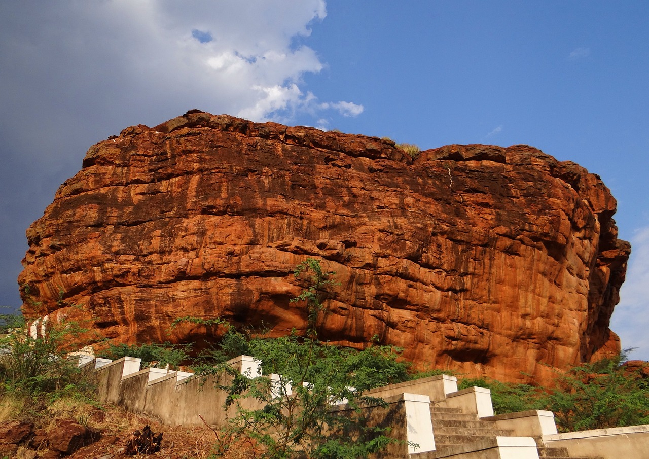
The Kudremukh Trek, named after the distinctive shape of the peak that resembles a horse’s face, offers trekkers a chance to experience the beauty of the Western Ghats in Karnataka. The name Kudremukh literally translates to “horse’s face” in Kannada, and the peak’s unique structure is the reason behind this intriguing name. Historically, the peak was also referred to as Samseparvath, as it was previously accessible from Samse village.
Located in the Chikkamagaluru district within the Kudremukh National Park, the trek to Kudremukh is a journey through lush grasslands, dense forests, and numerous streams. The park is the second-largest protected wildlife area in the Western Ghats and is home to an incredible variety of flora and fauna. The trek offers not only scenic views but also the chance to spot animals such as deer, peacocks, and even leopards.
Kudremukh stands at an altitude of 6,207 ft, making it the third-highest peak in Karnataka, after Mullayanagiri and Baba Budangiri. The trek offers a perfect blend of natural beauty and adventure.
Trek Overview:
- Peak Altitude: 6,207 ft
- Location: Kudremukh National Park, Chikkamagaluru District, Karnataka
- Difficulty Level: Moderate
- Trek Duration: 6-7 hours (one way)
- Distance: Approximately 9 kilometers (one way)
- Best Time to Visit: October to February
How to Reach Kudremukh Base:
The trek to Kudremukh Peak starts from Muddekkal village near the Kudremukh Forest Range office. Here’s how to get there:
- By Road:
- From Bangalore: Kudremukh is around 330 km from Bangalore, which will take approximately 7-8 hours by car.
- By Bus: You can take a bus from Bangalore to Chikkamagaluru and then hire a taxi to reach the base of the trek at Muddekkal village.
- By Train:
- The nearest railway station to Kudremukh is Chikkamagaluru. From here, you can take a local bus or taxi to the base of the trek.
Trekking Trail:

The trail to Kudremukh Peak takes trekkers through a variety of landscapes, from dense forests to rolling green hills. Here’s what you can expect along the way:
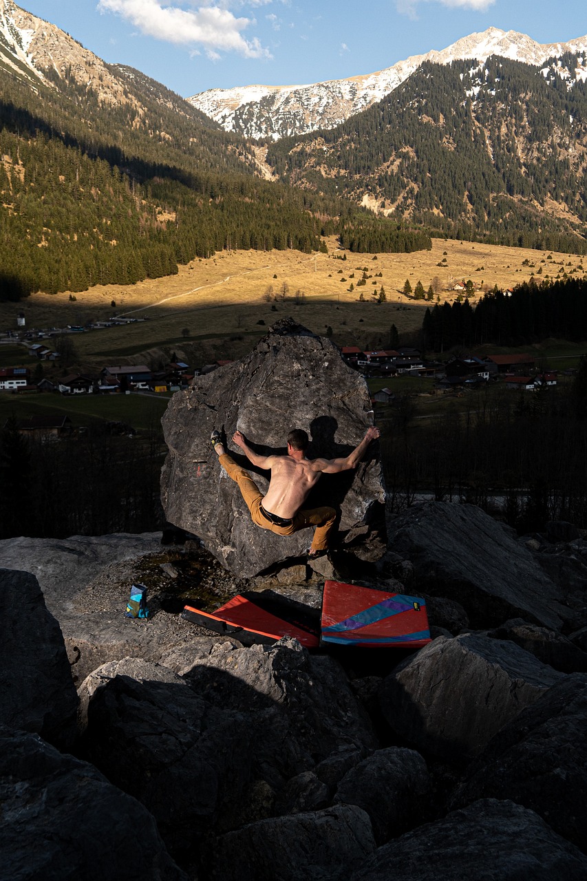
1. The Horse’s Face Structure:
One of the most fascinating features of the Kudremukh peak is the horse’s face shape, visible after about an hour of trekking from the Forest Range Office. While it may appear close, it is still about three more hours of trekking to reach this point. This iconic structure is a highlight for trekkers on this trail.
2. Trekking through the Shola Forest:
A significant portion of the trek takes you through Shola forests, a type of grassland and shrubland found in the Western Ghats. The area is teeming with wildlife such as deer, lion-tailed macaques, Malabar giant squirrels, and if you’re lucky, you might spot a leopard. The forest is also home to rare species of frogs.
- Monsoon Trekking: If you’re trekking during the monsoon, you will likely encounter leeches along the trail, so it’s important to be prepared with appropriate clothing and gear.
- Streams & Waterfalls: The trail crosses several small streams and waterfalls. Sometimes, you’ll need to wade through these streams, which may leave your shoes wet, but it adds to the adventure.
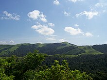
3. Rolling Hills and Misty Valleys:
Once you ascend through the forest, you’ll emerge into stunning rolling hills surrounded by misty valleys. The view is especially magical during the monsoon season, when the mist weaves in and out of the valleys, hiding and revealing parts of the landscape. It feels like you’re in the middle of a living painting, with hills covered in lush greenery and clouds playing hide and seek with the peaks.
The sight of these valleys, covered in mist and filled with the sound of nature, creates an unforgettable trekking experience. Every moment in this part of the trek feels like an awe-inspiring show by Mother Nature.

What to Pack for the Kudremukh Trek:
To make the most of your trekking experience, packing wisely is essential. Here’s what you should bring:
- Clothing:
- Comfortable, quick-dry clothes (especially during the monsoon)
- Warm clothing (since temperatures can drop in the higher altitudes)
- Waterproof jacket or poncho (for sudden rains)
- Trekking shoes (waterproof and sturdy)
- Trekking Gear:
- Backpack (light and sturdy)
- Trekking poles (to help with the uneven terrain)
- First aid kit
- Headlamp/torch (for low-light conditions)
- Food & Water:
- Snacks: Energy bars, nuts, and fruits
- Water: At least 2-3 liters (There are water sources along the trail, but it’s better to carry enough)
- Personal Items:
- Insect repellent (especially for leeches and mosquitoes)
- Sunscreen and hat (for sun protection)
- Camera to capture the breathtaking views
- A Detailed Guide to the Trail
Introduction:
The Kudremukh Trek offers trekkers a beautiful journey through dense forests, lush grasslands, and serene streams in the heart of the Western Ghats. Starting from the Forest Office in Kudremukh National Park, the trek is a moderate challenge for both nature lovers and adventure seekers. It leads to the peak, which offers stunning panoramic views and is known for its horse’s face shape, a prominent feature of the peak.
How to Start the Trek:
The trek begins early at the Forest Office, where you need to obtain permission to enter the national park. It is important to reach the forest office as early as possible to get your permit, as the trail can get busy, especially during peak trekking seasons. Once you have your permit, the journey begins.
You will immediately start hearing the soothing sound of water from Somawathi Falls nearby. The sound lingers with you as you embark on the trail, leading you to the Shola forest, where the landscape transforms into a dense, rich green environment.
Trekking through Shola Forest:
As you enter the Shola forest, the vegetation thickens around you, creating a magical atmosphere. The forest is home to diverse wildlife like deer, snakes, and earthworms, but don’t be surprised if you spot leeches on your trek, especially during the monsoon season. Keep an eye out for these creatures, and ensure you follow proper safety tips.
Important Tip:
Before starting the trek, apply Dettol or Savlon on your legs and feet to prevent leech bites. These can be removed once you reach the grassland or summit, but keeping them at bay will make your journey much more comfortable.
After a gradual ascent of about 15 minutes, you will encounter a stream. The water levels might be high if you’re trekking during the monsoon. The forest department has provided ropes to help trekkers cross the stream safely, particularly during peak monsoon times.
Tip:
Make sure to wear sturdy trekking shoes and carry trekking poles for better balance while crossing the stream.
The Ontimara & Scenic Views:
After you cross the stream, you will begin to exit the forest section and reach the first Ontimara, a secluded tree with a wide canopy. This spot provides the perfect resting area with a beautiful view of the valley below. You can take a break, enjoy the cool breeze, and watch the stream flowing through the valley while taking in the scenic views of the rolling hills ahead.
From the first Ontimara, the trail turns flat with Kudremukh Valley to your right and a mountain to your left. The terrain is a mix of grasslands with occasional dense trees. As you continue, you will cross another stream and reach a flat clearing offering a clear view of the Kudremukh Peak Ridge.
During the monsoon season, the trail can become slushy, so be prepared for muddy conditions. But trekking early in the morning might also offer you a chance to spot wildlife, such as a herd of deer grazing nearby.
Steep Ascent & Second Ontimara:
After trekking for about a kilometer, you will face a steep ascent of around 300 meters. This challenging climb leads you to the second Ontimara where you can rest and enjoy the view.
From the Forest Office, it should take you around 2 hours to reach the second Ontimara, a distinct marker along the trail. This is a great spot to pause and reflect before continuing towards the summit.
The Final Stretch:
From the second Ontimara, the trail continues with a mix of gradual ascents and descents. As you approach the Kudremukh Peak, you’ll experience an exhilarating sense of accomplishment with the rolling hills and misty valleys that surround you. The trek offers a mix of wildlife sightings, beautiful landscapes, and unique encounters with nature.
Once you reach the summit, the view from the top is breathtaking, offering a 360-degree view of the surrounding hills and valleys.- The Final Ascent to Kudremukh Peak
After reaching the second Ontimara, the trail begins with a gentle slope, giving you a brief respite before the final steep ascent. This part of the trek is incredibly scenic as you approach the Kudremukh Peak. The rolling green hills are your constant companions, offering a stunning view of the surrounding landscape as you climb.
20 Minutes of Gradual Trekking:
The first 20 minutes of this section consist of a gradual trek, allowing you to catch your breath while enjoying the views. As you move forward, the trail gradually starts to get steeper. At this point, the Kudremukh Valley becomes more visible, and you begin to get a better sense of the grandeur of the landscape surrounding you.
The Excitement Builds:
This is the most beautiful part of the trek. With the Kudremukh Peak now right in front of you, your excitement builds as you near the summit. By now, you should be reaching this point around 12 noon if you’ve started the trek at 8 am. It’s the perfect time to pause and take a moment to reflect.
Take a short break, drink some water, and enjoy the panoramic views of the Kudremukh Valley. At this point, you’re trekking deep in the heart of the valley, with the peak looming overhead. It’s an exhilarating feeling to be so close to your destination.
Reaching the Summit:
As you approach the top, you’ll realize that Kudremukh Peak isn’t the highest point. To get the best view, you need to descend slightly to a ledge below the peak. This is the perfect spot to take a break and relax while soaking in the views. The area can be windy, so be prepared for the breeze.
The View From the Top:
Once at the ledge, you’ll be rewarded with a spectacular 270-degree view of the rolling green hills below. If the weather cooperates, this is the perfect spot to take in the beauty of the surrounding landscape. However, don’t be discouraged if you find yourself surrounded by clouds and mist. It’s common for the peak to be covered in fog, and sometimes, you’ll only get a brief window of clarity. The shifting clouds create a dramatic and ever-changing view that is just as enchanting as the clear skies.
Be patient, breathe in the tranquility, and take time to appreciate the beauty around you. This is the highlight of the trek, and the moments of stillness and cloud play make the experience all the more magical.
Lunch at the Peak:
This is the perfect time to enjoy your lunch while perched at the top. Take in the serenity and peaceful surroundings as you refuel before the descent. It’s important to stick to your Turn Around Time (TAT), which should be 1 pm at the latest. This ensures that you have enough time to safely return before sunset.
Descending from the Peak:
After spending some time at the peak, it’s time to start your descent. The trek down will take a minimum of 3 hours, and the Forest Department has strict rules against trekking after 6 pm. The descent can be tricky in some places, especially on steep sections and in the forest areas where the trail can be slippery, particularly if it rains heavily.
Important Tips for Descending:
Use trekking poles effectively to maintain balance and stability, especially in the slippery sections of the forest.
Move carefully on the steep terrain. Take your time and don’t rush, as descending can be just as challenging as ascending.
Keep in mind that the forest section can become more difficult if it rains, so always be prepared for changing weather conditions.
By following these steps, you’ll safely complete the Kudremukh Trek, having experienced both the beauty of the peak and the adventure of the descent.

Best Time to Do the Kudremukh Trek
The best time to do the Kudremukh Trek is between June and February, offering the most pleasant weather conditions for trekking. However, the Kalasa region, where the trek is located, experiences good weather year-round.
- Monsoon (June to September): The region comes alive with lush green hills, small streams, and dark Shola forests. The waterfalls are particularly stunning, and the landscape is covered in vibrant greenery. However, there might be leeches during this time, and the terrain can be slippery, especially in the forest areas.
- Winter (October to February): The weather is cooler, with clear skies and rolling green hills. This is ideal for trekking as the climate is comfortable, and the views are unobstructed. You’ll also encounter dense bamboo shrubs that make the trek even more picturesque.
Note: Trekking in summer (March to May) is not recommended as the heat can be overwhelming, especially since some sections of the trek involve trekking under the open sky.
How to Reach the Kudremukh Trek
Reaching the Base:
The trek to Kudremukh begins at Mullodi village, about 15 km from Kalasa. Here’s how to reach the starting point:
- Step 1: Reach Kudremukh Entrance (10 km from Kalasa).
- Step 2: From the Kudremukh Entrance, hire a jeep to Mullodi village. The forest office, where you need to get permission to trek, is located here.
You can reach Kalasa either by your own vehicle or public transportation. From Kalasa, you’ll have to take a jeep to the Kudremukh Entrance.
How to Get to Kudremukh from Bangalore by Own Vehicle
- Route: Take the Chikkamagaluru road from Bangalore. Continue to Kottigehara, then take a right towards Kalasa. From the Kalasa Police Station, take a left towards Balagal, which will lead you to the Kudremukh Entrance.
- Jeep Ride: The road from the Kudremukh Entrance to the forest office is not in good condition. Park your vehicle near the entrance and hire a jeep for around Rs 150 per person. You can also pre-book a jeep from one of the homestays, which can cost around Rs 600 per person, including pickup, drop, meals, and more.
How to Get to Kudremukh from Bangalore by Bus
- Overnight Bus: You can take an overnight bus from Bangalore to Horanadu, which stops at Kalasa. The bus journey costs around Rs 750.
- From Kalasa: After reaching Kalasa, take a bus to Balagal village and get dropped at the Kudremukh Entrance. This leg of the journey costs around Rs 200 per person for the jeep ride to the forest office.
Return Option
- Bus from Kudremukh: You can book a return bus from Kudremukh Entrance to Kalasa, where you can find regular buses back to Bangalore. Buses from Kudremukh to Kalasa run every 15 minutes.
Nearest Railway Station and Airport
- Nearest Railway Station: Mangalore Railway Station (120 km away).
- Nearest Airports:
- Mangalore International Airport (115 km away).
- Bengaluru International Airport (approximately 300 km away).
- 🐴 The Complete Guide to the Majestic Kudremukh TrekKudremukh—a name that literally translates to “Horse’s Face” in Kannada, thanks to the distinctive, equine shape of its peak. Known historically as Samseparvath, this magnificent trek leads you deep into the heart of the Western Ghats.Nestled in the Chikkamagaluru district, Kudremukh peak stands tall at 6,207 ft (1,892 m). It is Karnataka’s third-highest peak, trailing only Mullayyanagiri and Baba Budangiri. This entire region falls under the Kudremukh National Park, the second-largest wildlife protected area in the Western Ghats, promising a trek through unparalleled natural beauty.Prepare for an enchanting journey across rolling green hills, misty valleys, dense Shola forests, and numerous sparkling streams!⛰️ Why Kudremukh is a Must-Do Trek1. The Iconic Horse’s Face ViewAbout an hour into the trek, keep an eye out for the spectacular sight that gives the peak its name. The unique profile, resembling a horse’s face, becomes clearly visible from the side. While it may look close from this vantage point, you still have a beautiful three-hour climb ahead to reach the base of that structure.2. The Enchanting Shola Forests & StreamsShola is the local term for the unique mosaic of high-altitude grasslands and stunted, dense forests found only in the Western Ghats. You will traverse these mystical sections, which are a vital habitat for incredible wildlife, including deer, the Malabar giant squirrel, lion-tailed macaques, and even leopards.💡 Monsoon Alert: During the wet season, the Shola sections are lush but are notorious for leeches! Prepare with Dettol/Savlon applications and proper gear.One of the most thrilling parts of this section is the multiple stream crossings and small waterfalls. Be prepared to get your shoes wet as you navigate these beautiful water bodies! Ropes are often installed by the forest department during peak monsoon for safety.3. Spectacular Vistas of Rolling Green HillsThe Kudremukh trek is a visual feast. Imagine endless emerald-green hills stretching to the horizon, with dense mist weaving through the valleys below. During the monsoon, this landscape transforms into a magical realm, with clouds and mist playing hide-and-seek with the peaks, offering a constantly changing, breathtaking view that makes every moment on the trail special.🗺️ Detailed Trail InformationThe Kudremukh trail is 9 km one way (18 km total) and is generally considered of Moderate difficulty. It can be broken down into three distinct, memorable sections:SectionDistanceApprox. DurationHighlightsI5 km2 hoursForest Office to Ontimara (Lone Tree)II3 km1 hourOntimara to the Final Stretch (Steep Ascent)III1 km30 minutesFinal Stretch to Kudremukh PeakSection I: Forest Office to Ontimara (Lone Tree)Start: Begin your trek at the Forest Office, securing your mandatory permit and guide.The Forest: The initial stretch is a gradual ascent through the dense Shola forest. Listen for the sound of Somawathi Falls as you start.Stream Crossings: You will encounter several streams here. Wear proper trekking shoes and consider a trekking pole for stability on the slippery rocks.Ontimara 1: As you exit the forest, you reach the first ‘Lone Tree’ with an inviting canopy and seating, offering beautiful views of the valley—a perfect rest spot.Ontimara 2: A mix of flat grassland walking and a steep ascent leads you to the second, most distinctive ‘Ontimara’—a significant landmark just two hours from the start.Section II: Ontimara to the Final StretchThis 3 km stretch is perhaps the most scenic. You trek through gentle slopes that turn steeper, with the magnificent Kudremukh valley opening up before you.The excitement builds as the iconic peak appears right in front of your eyes!Tip: Utilize your trekking pole here to aid your ascent on the steeper sections.Section III: Final Stretch to the Kudremukh PeakTarget Time: Aim to reach this final point around 12:00 PM.The final 1 km is a last push, taking about 30-35 minutes of uphill climb.The Summit: At the top, look for the board and the pile of stones marking the highest point. The peak is often shrouded in clouds and mist.The View: Walk to the ledge for the possibility of a 270-degree view of the uneven green carpets below. Be patient; the clouds will give you a window of opportunity to capture the stunning scenery.⚠️ Turn Around Time (TAT): You must begin your descent by 1:00 PM sharp from wherever you are on the trail. The descent takes a minimum of 3 hours, and the Forest Department has strict restrictions after 6:00 PM.🗓️ Best Time to Trek KudremukhThe ideal season for the Kudremukh Trek is from June to February.Monsoon (June – September): The most visually stunning time. Expect abundant streams, dense mist, leeches, and lush green rolling hills.Winter (October – February): Pleasantly cool and clear weather, offering the best views with less mist.Summer (March – May): Trekking is not recommended due to high temperatures and long sections under the open sky.🚌 How to Reach Kudremukh TrekThe trek officially starts at the Forest Office in Mullodi village, about 15 km from the town of Kalasa.🚗 By Own Vehicle (From Bangalore)Take the route via Hassan and Chikkamagaluru to Kalasa.From Kalasa, proceed to the Kudremukh Entrance point (about 10 km).Parking: Park your vehicle near the shops at the entrance. The road to Mullodi/Forest Office is rough.Jeep Transfer: Hire a local jeep from the entrance to Mullodi village (the Forest Office). They charge around ₹150-200 per person.Tip: Inform your pre-booked homestay owner the day before; they can arrange a cheaper pickup.🚌 By Bus (From Bangalore)Book an overnight KSRTC bus to Horanadu via Kalasa.Get down at the Kalasa bus station (approx. 6:00 AM).From Kalasa, take a local bus toward Balagal and ask to be dropped at the Kudremukh Entrance (10 km journey).From the Entrance, hire a jeep to the Forest Office. (The Forest Office is a 5 km walk from the entrance, an option if you start very early.)🎒 What to Pack for Kudremukh TrekIdentity Card (Mandatory for permits)Water: Minimum 2 litres. Carry a reusable bottle—mineral water bottles are counted and must be brought back to avoid a fine!Electrolytes: Lemon/Salt or an Electrolyte powder (Glucon D, Electral).Food: High-calorie snacks (nuts, dried fruit). No packaged food is allowed; use a reusable dabba for all snacks.Clothing: Quick-dry, full-sleeve T-shirts are best. A Poncho is essential during monsoons.Footwear: Proper, sturdy trekking shoes.Gear: Optional but highly recommended: Trekking poles (especially for steep sections and slippery crossings).First Aid Kit: Including Band-Aids, Antiseptic, Crepe Bandage, and mild pain relief/acidity tablets.❓ Essential FAQsQuestionAnswerIs a Guide Mandatory?Yes. The Forest Department mandates that all trekkers take a local guide. They are assigned at the Forest Office.Are Permits Required?Yes. Permissions must be applied for and secured online via the Aranya Vihaara Website.Can Beginners do this trek?A fit beginner can attempt this. The 18 km distance requires good endurance, but there are no technical sections.Can we Camp?No, camping on the peak is not allowed. Homestays in Mullodi offer a tent stay option near the base.Where can I stay?Many homestays are available in Mullodi village, close to the Forest Office. Pre-booking is essential.Are Food/Water sources available?Homestays provide pre-booked breakfast and packed lunch. Water can be filled from streams (use purification tablets if uncomfortable).🏞️ Places to Visit NearbyExtend your trip and explore more of the region!Towards BangaloreHoranadu Temple: Famous temple on the banks of the Bhadra river (16 km from the entrance).Netravati Trek: A newly discovered, easy trek with excellent views.Ballarayanadurga Fort Trek: Can be done from Durgadahalli (36 km away).Towards MangaloreHanuman Gundi Falls: A beautiful fall located inside the National Park (22 km away).Kurinjal Peak: A lesser-known trek in the National Park, offering a quieter trail (20 km away).Gangadikal Trek: An easy trek providing panoramic views of the Lakya Dam backwaters.Ready to experience the lush green carpets of the Western Ghats?